
Using LiDAR sensors to measure the free surface in channels
Testing drone applications for monitoring rivers and channels
- Campus: Casa Central campus
- Posted on
Measuring the free surface in channels with LiDAR sensors: controlled experiments and prospects for drones
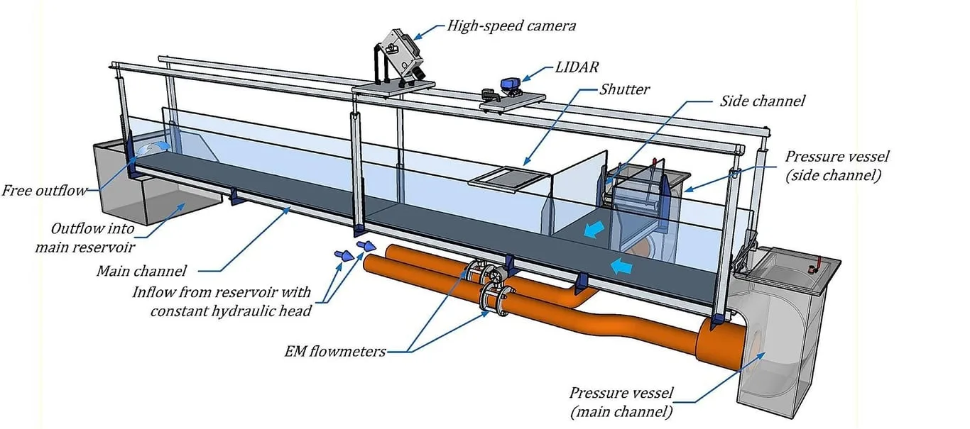
In this thesis you will deploy LiDAR (Light Detection and Ranging) sensors in controlled settings, such as laboratory hydraulic flumes, to measure the water level (the free surface) accurately. You will analyze data under different flow conditions and validate it against traditional methods. The goal is to develop protocols that can later be adapted to drone-mounted LiDAR for measurements in natural rivers, supporting discharge estimates, flood forecasting and water resources management in a context of climate change.
The thesis is carried out with Universidad de Valparaíso, whose laboratories will host the experiments and initial validation, with a possible extension to drones in the field.
Possible applications include rivers, irrigation canals and drainage systems.
Objectives
- Install and calibrate LiDAR sensors in controlled channels to measure the free surface elevation.
- Process and analyze LiDAR data under different flow rates and turbulence levels.
- Compare the results with conventional measurements and assess accuracy, noise and limitations.
- Propose adaptations to integrate the system into drones, including preliminary tests in real settings.